Monday, 3 December 2012

Ship Tracks over the Atlantic


A maze of long white clouds is interwoven into the uneven field of white that covers the Atlantic Ocean off the east coast of the United States. Though these clouds may resemble airplane contrails, the streaky clouds of condensation that follow in the wake of jet airplanes, they are actually ship tracks, clouds that form around the exhaust released by ships into the still ocean air. Water molecules collect around the tiny particles (aerosols) from exhaust to form a cloud seed. More and more water accumulates on the seed until a visible cloud is formed. In the case of ship tracks, the cloud seeds are stretched over a long narrow path where the wind has blown the ship’s exhaust, so the resulting clouds resemble long strings over the ocean.

Ship tracks provide important clues about how human-produced aerosols affect cloud formation. Though the exhaust released by ships is not a significant source of pollution, it does modify clouds, and that could have an impact on climate. When a large number of aerosol particles are in the atmosphere, water condenses onto a large number of “seeds” instead of gathering around fewer, larger seeds. As a result, ship tracks are brighter or more reflective, carry more water, and may inhibit rainfall. For more information about ship tracks, read “Every Cloud has a Filthy Lining’ on the Earth Observatory.

This image of ship tracks was taken by the Moderate Resolution Imaging Spectroradiometer (MODIS) on NASA’s Terra satellite on May 11, 2005.

NASA image courtesy Liam Gumley, Space Science and Engineering Center, University of Wisconsin-Madison

Sunday, 2 December 2012

SA National Severe Weather Warnings: 2 December 2012 04h59 SAST


NOTE:  Last updated 2/12/2012 04h59 SAST

Current warning: Eastern Cape Province
Updated: 02/12/2012 04:59:04
Validity: 2012-12-02 to 2012-12-02
Type: Watch. Be prepared
Subject: Heavy Rainfall
Detail: Heavy rainfall ( > 50mm) are expected in places in northern interior.


Current warning: Free State Province
Updated: 02/12/2012 04:59:04
Validity: 2012-12-02 to 2012-12-02
Type: Watch. Be prepared
Subject: Heavy Rainfall
Detail: Heavy rainfall ( > 50mm) are expected in places.


Current warning: North West Province
Updated: 02/12/2012 04:59:04
Validity: 2012-12-02 to 2012-12-02
Type: Watch. Be prepared
Subject: Heavy Rainfall
Detail: Heavy rainfall ( > 50mm) are expected in places in central and western parts.


Current warning: Northern Cape Province
Updated: 02/12/2012 04:59:04
Validity: 2012-12-02 to 2012-12-02
Type: Watch. Be prepared
Subject: Heavy Rainfall
Detail: Heavy rainfall ( > 50mm) are expected in places in eastern parts.


Current warning: All other Provinces
Updated: 02/12/2012 04:59:05
Validity: 2012-12-02 to 2012-12-02
No warnings nor advisories in effect
Subject: No Alerts
Detail: No Alerts

- SAWS

SA Weather Satellite Image: 2 December 2012 17h00 SAST


Image: Eumetsat (Click on image for larger view.)

Fire destroys 2 shacks in Khayelitsha – 8 people displaced


A fire occurred at 03:53 on Sunday, 02 December 2012 at 9548 Ndlovu Street, Monwabisi Park, Khayelitsha.

The fire destroyed two (2) wood and iron structures causing the displacement of eight (8) persons.

The City’s disaster response teams aided the families with food parcels, clothing, blankets and building material.

No persons sustained any injuries and the cause of the fire is undetermined.

The cause of the fire is undetermined.

End

Issued by: Disaster Risk Management Centre, City of Cape Town


Source: Wilfred Solomons-Johannes, Head: Systems Integration, Special Projects and Disaster Operations, Disaster Risk Management Centre, City of Cape Town

HAMNET Bulletin: December 2012


HAMNET THE SOUTH AFRICAN RADIO LEAGUE EMERGENCY COMMUNICATION BULLETIN FOR DECEMBER 2012

This bulletin was prepared and produced by Francois Botha – ZS6BUU

HAMNET (IARU Region 1) dedicated emergency communication frequencies are:-

80m band – 3,760 MHz, 40m band, 7,110 MHz. 20m band – 14,300 MHz.


IN THE BULLETIN TODAY

NEW LICENSING PROCEDURE

NO ANTENNA’S PLEASE!

DECEMBER/JANUARY HOLIDAY’S


HAMNET conforms to and abides by the IARU discipline of engaging in emergency communication locally and worldwide during and after disasters as internationally Amateur Radio is regarded as a National Resource!


HAMNET, as a group of volunteers, supports Disaster Risk Management in South Africa and serves on the sub committee of the South African Search & Rescue Organisation – SASAR!


It is recommended that when becoming a member of HAMNET, you also become an SARL member to abide by and conform to the IARU International and HAMNET rules regarding emergency communication!


All HAMNET information is available on www.hamnet.co.za alternatively www.sarl.org.za just follow the link! Weekly updates are supplied to Amateur Radio Today on Sunday’s and a monthly bulletin is supplied to members and available on the SARL website and as a podcast!


You can also follow us on Facebook and Twitter


NEW LICENSING PROCEDURE’


At the ICASA/SARL Liaison committee meeting held this month, ICASA informed the SARL that following a qualified audit by the Auditor General, ICASA has been instructed to implement regulation 15 of the Radio Frequency Spectrum Regulations which stipulate that an amateur radio license can only be renewed for up to five years after which a new application has to be submitted. All Radio Amateurs will be required to re-apply for a license for the period of 1 April 2013 till 31 March 2018. Payment of the annual license fee can be made annually or for the full 5 year period in which case a discounted rate applies.

Details are expected to be gazetted in the next few weeks. Do nothing right now. SARLNEWS and HAMNET will keep you informed and the requirements, procedure and the necessary forms will be made available on www.sarl.org.za after the publication of the Government Gazette.


It appears from comments received that this is common practice in other parts of the world and we should just adapt to changing situations. More to follow!


NO ANTENNA’S PLEASE


I recently had an interesting conversation with Bob Lech – AF2Q. Bob is an American citizen but is currently working on assignment in Sri Lanka.


Through a comment I made regarding emergency communication, Bob responded that he himself is involved with Emergency Communications but that due to the inconsiderate attitude and misinformation of so many people in the USA, many amateurs are considering giving up the hobby and no longer getting involved in emergency communication!


But it goes a lot further than that; also giving up valuable experience, equipment and input to a simple thing yet a critical aspect of our hobby called ‘emergency communication’


This in itself is very sad! It is a well-known fact, all over the world, that amateur radio really is your only ‘fail safe’ communication system when it comes to supplying that much needed facility, when all else is down or fails! People tend to forget that cell phones, landlines, satellite phones and all other established and accepted means of communication are not infallible! They do fail!


If you have a neighbour who has an issue with your antenna(s) – even if it is a simple inverted V, unobtrusive and if well-tuned, should not cause any ‘interference’ to any electrical or radio, hi fi equipment near to your ‘station’.


Yes, it is difficult to explain to any neighbour, it is not your antenna but his inexpensive (though expensively purchased) equipment that has not been adequately screened or filtered to reject interference!


If all else fails, get your station cleared by the authorities but leave it to the authorities to explain to your neighbours it is their problem and not yours!


But, towers are another problem and we will have to wait for new legislation to be formulated. However, the SARL and its legal team are involved in all and any discussion related to this issue at present!


Please watch the SARL website for further updates and press releases!


SCHOOL HOLIDAYS


The ‘silly season’ is again upon us.


All schools close on the 7th of December and by all accounts our first weekend for monitoring will be the weekend of 14 through 17 December. The next period will be from 21 through 26 December.


This is longer than usual as we anticipate that many businesses will close leaving the Monday the 24th as forming part of that break period.


Planning a monitor period from now becomes a bit of a gamble as some will return after the Christmas week period whilst others will leave it to the 1st or 2nd or January – depending in which Province you reside as in the Cape, 2nd of January is also regarded as a public holiday.


But, whichever way you look at it, HAMNET members will be monitoring all its emergency frequencies on an on-going basis from Friday 7 December to the first week in January up to and including Sunday the 6th of January 2013.


To report an adverse or poor road conditions, please remember the JAMLINE number listed under emergency numbers.


GENERAL


Hamnet did an investigation into any amateur radio enthusiast being questioned/harassed by any Police Officer regarding radio equipment in his/her vehicle at a road block!


We spoke to a senior Police Captain – who himself is an amateur radio enthusiast and he indicated that at any roadblock, the Police have no authority to ask you why or what you do with the equipment in your vehicle.


It has absolutely nothing to do with them what so ever. They are not there to query your equipment; they are there to search for the assignment issued to them by their Commanding officer of the day – which invariably will be drugs, dagga, stolen vehicles, etc.


However, we do suggest that you be polite, show them your amateur radio licence if necessary and if they are still reluctant to let you go, you have every right to take his name rank and number and report him to your nearest Police Station as he is overstepping his authority!


FINALLY


This is a pretty long insert/article, submitted by Gordon Forbes, ZS6FI, he came across and so vividly describes the value of not only amateur radio but also being involved in an emergency group like HAMNET! It makes for very interesting reading!


http://ulsterherald.com/2012/11/15/benny-prevents-airline-disaster/


Enjoy the December/January break!


INFORMATION FOR REFERENCE PURPOSES!


The following frequencies are purely calling frequencies-

‘Eightynet’ 3.695 MHz ‘Fortynet’ 7.095 MHz ‘Thirtynet’ 10.135 MHz

‘Twentynet’ 14.295 MHz


PROVINCIAL DIRECTOR AND 2ND IN COMMAND CONTACT LIST.


PROVINCE

DIRECTOR/2nd COMMAND

CELL NUMBER

WESTERN CAPE

Paul van Spronsen ZS1V

083 302-3366

WESTERN CAPE

Dave Reece ZS1DFR

083 270-6843

NORTHERN CAPE

Daniel Swart ZS3DS

082 884-1200

NORTHERN CAPE

Carel Oberholzer ZS3OBE

082 805-0181

EASTERN CAPE

Serge Smetryns ZS2SJE

084 515-1077

EASTERN CAPE


KWAZULU-NATAL

Keith Lowes ZS5WFD

082 685-6666

KWAZULU-NATAL

Glenham Duffy ZS5GD

082 962-6681

FREE STATE

Vacant


FREE STATE

Martin Schwella ZS4MS

082 968-3765

NORTH WEST

Chris Viljoen ZS6BYQ

082 857-8641

NORTH WEST

Johan Bamberger ZS6LVG

018 297-1900

GAUTENG SOUTH

Chris Gryffenberg ZS6COG

083 543-5668

GAUTENG SOUTH

Andre van Tonder ZS6HE

082 554-7469

GAUTENG NORTH

Johan de Bruyn ZS6JHB

082 492-3689

GAUTENG NORTH


MPUMALANGA

Gert Botha ZS6GC

082 771-0663

MPUMALANGA

Strauss Roux ZS6JFS

076 430-5082

MPUMALANGA

Piet Badenhorst ZS6G

082 574-4829

LIMPOPO

Vacant


LIMPOPO

Vacant


NATIONAL DIRECTOR

Francois Botha ZS6BUU

083 585-3847

NATIONAL DIRECTOR

Jan Schubart ZS6ARV

082 458-1484


WEATHER INFORMATION –

www.sawdis1.blogspot.com

To send weather information - 076 251 3482 - Text Messages Only!!

Alternatively - sawois05@gmail.com

www.weatherphotos.co.za – Highly recommended for up to date information!


USEFUL NUMBERS IN EMERGENCIES:-


1. AMBULANCE – 10177

2. ER24 – 084 124

3. Werner Vermaak Direct ER24 real emergencies only (Gauteng) 082 907.4557

4. TRAFFIC – 112

5. WESTERN CAPE ALL EMERGENCIES 021 937-0300

6. JAMLINE - 084 5265463

7. CRIME LINE – 32211 alternatively 08600 10111. HAMNET actively supports the SAPS and CPF to fight crime!

8. N3 Toll Concession Help Line – 0800 N3 HELP or 080063 4357

9. Graham – Maritime Mobile Net 046 648-1071 (Maritime Emergency Only)

10. Sam Maree – Maritime Mobile Net 021 782-2840 (Maritime Emergency Only)

11. MRCC – 021 938-3300 (Only in dire Maritime emergencies)


Comments suggestions and contributions please contact or send to: jfbotha@iburst.co.za or zs6buu@gmail.com or at 011 679-5260 or 083 585-3847. Fax 086-580.6110.

Bulletin ends.

Fires destroys 139 shacks: City’s disaster response teams aids over 400 homeless people – 2 people dies


MUIZENBERG: At 21:57 on Saturday, 01 December 2012 a fire occurred at Philemon Street, Vrygrond Informal Settlement in Muizenberg. The fire destroyed 6 wood and iron structures that resulted in the displacement of 20 people.

STRAND: A fire that was reported at 23:20 on Saturday, 01 December gutted 15 wood and iron structures at the Onverwacht Informal Settlement, Overwacht Street in Strand. As a result 30 people [30 adults and 7 babies] are left homeless.

NYANGA: A catastrophic fire that broke out at 01:51 during the early hours of this morning [Sunday, 02 December 2012] wrecked 118 shacks at the New Rest Informal Settlement, off Eisleben Road in Nyanga. The fire left 369 people [263 adults and 106 children] destitute. Nkosiyedwa Nqandi (38 years) and Msondezi Mponda (30 years) that were trapped when their structures were surrounded by the blaze that could not escape and was declared deceased on-scene by paramedics.

The City’s disaster response teams assisted the victims that were affected by the blaze with clothing, food parcels and blankets; building materials; including emergency psychosocial trauma counselling for the families of the deceased and eyewitnesses.

The fires also damaged the overhead electricity infrastructure that caused an interruption in the power supply – the City’s technicians of the Electricity Services Department are in the process of restoring the service in the area.

The cause of these fire incidents is undetermined and the authorities will investigate.

The South African Police Services that also opened inquest dockets regarding these incidents.

End

Media enquiries:

* Wilfred Solomons-Johannes, Head: Systems Integration, Special Projects and Disaster Operations, Disaster Risk Management Centre, City of Cape Town

Photos: Weather Observation: South Africa (1 December 2012 Part 2)


SAWDOS - Sunset Mossel Bay 1 December 2012


Ziyaad Warasally - Storm over the Besters area


Estelle Pienaar - Sunset - Southern Suburbs, Cape Town


Elna Dreyer - Cape Town 20h00 taken from Canal Walk Century City.

Weather warning for Cape Town cancelled: City’s disaster response teams continuing repairing infrastructure and assisting households


Gale force winds that persisted since Thursday night caused major damage to properties throughout the Cape Town.

In the morning of Thursday, 29 November 2012 the SA Weather Service issued a weather watch that City’s Disaster Risk Management Centre should be on alert and prepared as a result of gale force south-easterly winds that were forecasted reaching 35 knots or 65 km/h between Cape Columbine and Cape Agulhas.

The weather watch was upgraded in the morning of Friday, 30 November 2012 to a warning and that the City’s Disaster Risk Management Centre should take action and place all disaster response teams on high-alert for the gale force south-easterly winds that was forecasted at 35 knots or 65 km/h between Cape Columbine and Cape Agulhas for yesterday [Friday] and today [Saturday, 01 December 2012].

Since Thursday night the City’s Electricity Services had to deal with 93 wires that were blown down in Athlone, Bantry Bay, Bergvliet, Bonteheuwel, Brackenfell, Cape Town Central City, Claremont, Crawford, Fish Hoek, Fresnaye, Gardens, Grassy Park, Green Point, Kensington, Kraaifontein, Lansdowne, Llandudno, Mfuleni, Milnerton, Muizenberg, Ndabeni, Oranjezicht, Pinelands, Retreat, Rondebosch, Rugby, Schotschekloof (Bo-Kaap), Sea Point, Sir Lowry’s Pass, Strand, Tamboerskloof, Three Anchor Bay, Wetton, Woodstock and in Zandvlei.

The City’s disaster response teams effected emergency repairs to all the electricity infrastructure that were affected and restored the supply to all areas.

The gale force wind conditions also blown several trees down and 132 incidents were recorded for the following areas since Thursday night: Athlone, Bantry Bay, Bellville, Bergvliet, Bloubergrant, Bonteheuwel, Camps Bay, Cape Town City Centre, Claremont, Constantia, Devil’s Peak, Durbanville, Edgemead, Freshnaye, Gardens, Goede Hoop, Goodwood, Gordon’s Bay, Grassy Park, Green Point, Hout Bay, Kalkfontein, Kenilworth, Kraaifontein, Kuils River, Lakeside, Llandudno, Lotus River, Maitland, Mamre, Mfuleni, Mitchell’s Plain Monte Vista, Moule Point, Muizenberg, Newlands, Oranjezicht, Ottery, Parow, Pinelands, Plumstead, Retreat, Rondebosch, Schotschekloof (Bo-Kaap), Sea Point, Sir Lowry’s Pass, Somerset-West, Stellenberg, Strand, Tamboerskloof, Woodstock and in Wynberg.

The City’s disaster response teams continued to clean up the debris where trees were blown down and made areas safe since Thursday night.

The following damages have been reported in the respective areas:

SEA POINT: In the evening of Thursday, 29 November 2012 gusting wind conditions along the Atlantic seaboard resulted in the roof sheeting of several buildings been blown off. The airborne debris has caused substantial damages to seven (7) motor vehicles and adjacent properties.

BO-KAAP: In the Bo-Kaap, the roof of a house in Longmarket Street blew off and debris landed in a cemetery in the vicinity in the evening of Thursday, 29 November 2012.

STRAND: At 14:35 on Friday, 30 November 2012 the gusting winds blown down 5 structures situated on Vlakte Plaas Informal Settlement, off Broadlands Road, near Strand.

STRAND: At 18:30 Friday, 30 November 2012 roof sheeting were blown off a structure as a result of gale force wind conditions at 20341 Konyini Street, Nomzamo in Strand.

MACASSAR: It was reported at 16:58 on Friday, 30 November 2012 that the roof of an informal structure at 63 Japonica Way, Macassar was damaged as a result of gusting wind conditions.

SOMERSET WEST: At 08:45 on Saturday, 01 December 2012 the roof of a backyard dwelling were blown off at 3 Rose Street, Garden Village in Somerset West.

SIR LOWRY’S PASS: During the early hours of this morning a tree fell on a roof of an informal structure that was situated at 619 Van Aarde Street, Sun City Informal Settlement, in Sir Lowry’s Pass. The occupants fortunately evacuated out of the structure before the tree has fallen.

SIR LOWRY’S PASS: At approximately midday on Saturday, 01 December 2012 the gusting wind conditions blown down an informal structure at SP471 Uitkyk Informal Settlement in Sir Lowry’s Pass.

SIR LOWRY’S PASS: A tree collapsed on a roof on an informal structure at situated at 705 Mandela Drive, Sun City Informal Settlement, in Sir Lowry’s Pass around midday on Saturday, 01 December 2012.

No deaths or injuries had been reported by the City’s Disaster Risk Management Centre.

The disaster response teams assisted the affected household that is indigent that called upon the City of Cape Town for assistance to remove trees and for the provision of social relief aid.

This morning [Saturday, 01 December 2012] the SA Weather Service downgraded the weather warning and subsequently issued a forecast for cloudy conditions with showers and thunder-showers expected for the Cape Peninsula.

This afternoon the weather warning was cancelled as there was a significant improvement in the weather system.

The Cape Peninsula can experience for the next few days cloud on the mountains, with partly cloudy conditions and in some places there will be clear skies.

The South African Weather Service will keep the City’s Disaster Risk Management Centre informed regarding weather conditions, and further advice will be made available if and when required.

Residents are reminded to use the 107 number in the event of an emergency so that the nearest relevant emergency service provider can be dispatched. Dial 107 from a landline or 021 480 7700 from a cellphone. The sooner you phone, the sooner help will arrive.

The reports of damage to infrastructure, trees blown down or service disruptions can be reported to the City’s Customer Contact Centre at 0860 103 089. Enquiries and/or complaints can also be sent via SMS to 31373. Enquiries and/or complaints regarding electricity fault reporting can be sent via SMS to 31220.

The City’s Transport Information Centre can be contacted on 0800 65 64 63 regarding delays on roadways and deviations.

For further information and precautionary measures to prevent wind damage visit the website of the Disaster Risk Management Centre on www.capetown.gov.za/disaster.

End


* Wilfred Solomons-Johannes, Head: Systems Integration, Special Projects and Disaster Operations, Disaster Risk Management Centre, City of Cape Town

SA National Severe Weather Warnings: 2 December 2012 04h00 SAST


Current warning: Eastern Cape Province
Updated: 02/12/2012 04:59:04
Validity: 2012-12-02 to 2012-12-02
Type: Watch. Be prepared
Subject: Heavy Rainfall
Detail: Heavy rainfall ( > 50mm) are expected in places in northern interior.


Current warning: Free State Province
Updated: 02/12/2012 04:59:04
Validity: 2012-12-02 to 2012-12-02
Type: Watch. Be prepared
Subject: Heavy Rainfall
Detail: Heavy rainfall ( > 50mm) are expected in places.


Current warning: North West Province
Updated: 02/12/2012 04:59:04
Validity: 2012-12-02 to 2012-12-02
Type: Watch. Be prepared
Subject: Heavy Rainfall
Detail: Heavy rainfall ( > 50mm) are expected in places in central and western parts.


Current warning: Northern Cape Province
Updated: 02/12/2012 04:59:04
Validity: 2012-12-02 to 2012-12-02
Type: Watch. Be prepared
Subject: Heavy Rainfall
Detail: Heavy rainfall ( > 50mm) are expected in places in eastern parts.


Current warning: All other Provinces
Updated: 02/12/2012 04:59:05
Validity: 2012-12-02 to 2012-12-02
No warnings nor advisories in effect
Subject: No Alerts
Detail: No Alerts

- SAWS

SA Weather Satellite Images: 2 December 2012 06h00 SAST


Images: SAT24 (Click on images for larger view.)

GFS Medium Range Forecasts of Vertical Velocity and Precipitation: South Africa

Image: U.S. National Center for Environmental Prediction (NCEP)


Image: 1stweather (Click images for larger view.)

Sea Level Synoptic Chart: South Africa (2 December 2012)


- SAWS

HAMNET weekly report 2/12/2012


A few weeks ago, there was a media report of a hiker that went missing in the Bain’s Kloof Pass area. Herewith an abridged report from David le Roux, ZS1DAV!

It appears that a hiker went missing in the Bain’s Kloof Pass region a few weeks ago where he was staying. From various reports this hiker was hiking alone and if it were not for the observation of a resident from Wellington and some friends who were picnicking in the area; it may have taken a lot longer for the body to be recovered.

This picnicker saw what he thought was a person on a ledge near the tarred road winding its way over the pass and as it was getting dark, no further investigation could be done. The next morning through media releases, he realised that what he saw could be the lost hiker and immediately informed the Police.

It appeared that the hiker had fallen off a cliff of about 10 metres with result that his body was not visible from the road.

Wilderness Search and Rescue, Hamnet and Metro became involved in the search and by the time the various volunteer groups arrived on the scene, the Police treated this as a crime scene. The whole Pass was closed to traffic probably to allow the Police to search for clues. David reported that communication conditions in the area were very good as all search units were almost in sight of each other.

Crowd control at this point became important and recovery of the body was difficult, due to the steep cliff. However, retrieval was accomplished by a well experienced Fire team.

Many lessons were again learnt from this experience and at debrief all the issues were discussed in detail as a sharpener for the next event.

Reporting for Hamnet, this is Francois Botha – ZS6BUU.

Activity at Tolbachik Volcano


Tolbachik Volcano on Russia’s Kamchatka Peninsula showed signs of unrest in late November 2012. The Moderate Resolution Imaging Spectroradiometer (MODIS) on NASA’s Terra satellite detected unusually high surface temperatures and an apparent ash plume on November 29 (top image). For comparison, the bottom image shows the volcano before any obvious activity occurred.

Both images are natural color. The red outlines in the November 29 image approximate the areas with high surface temperatures associated with volcanic activity. In both images, volcanic peaks cast long shadows to the north, thanks to the low angle of the Sun. By the time MODIS observed the region on November 29, the volcano had released a dark brown ash plume that settled on the snow.

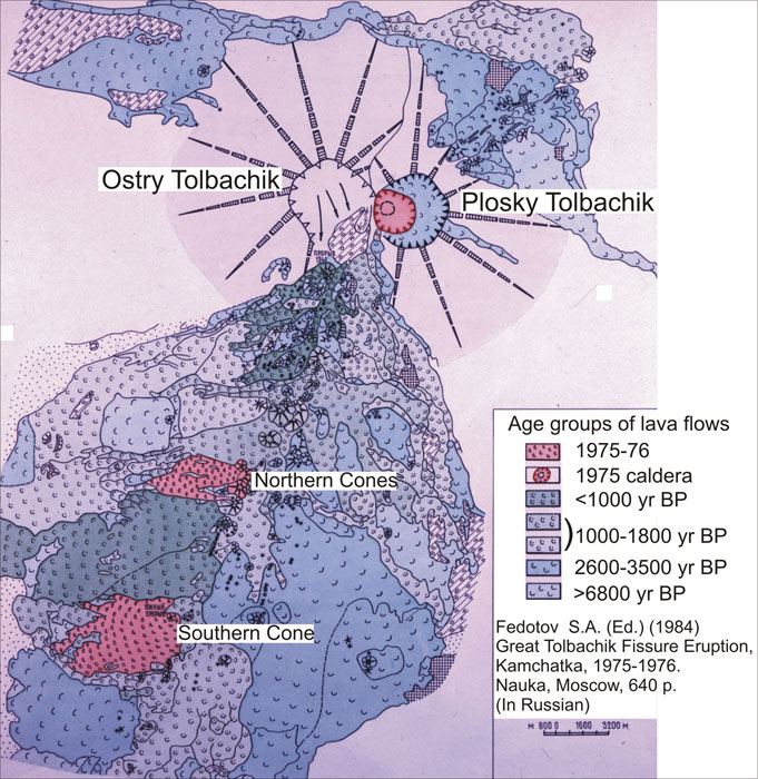
Tolbachik is a shield volcano—a low-profile, broad structure with a shape resembling an ancient warrior shield. The volcano has a complex configuration, and the eruptive activity in late November reportedly occurred around the southern cone. Reports described eruptions from two fissures, a volcanic ash plume reaching 3 kilometers (9,800 feet) in altitude, and emissions of sulfur dioxide.

Tolbachik’s last known eruption occurred in 1976, according to the Global Volcanism Program at the Smithsonian. Volcanologist Erik Klemetti of Denison University remarked that, although the volcano showed signs of an eruption similar to what it experienced in the 1970s, “the magnitude of this new eruption is still very unclear.” Tolbachik is one of numerous volcanoes on the Kamchatka Peninsula, part of the Pacific “Ring of Fire” where earthquakes and volcanic activity occur frequently.

MODIS acquired additional images of Tolbachik in late November 2012, including another image from November 29, and an image from November 30.
  1. References

  2. Global Volcanism Program. Tolbachik. Smithsonian Institution. Accessed November 30, 2012.
  3. Klemetti, E. (2012, November 28) First images of the Tolbachik fissure eruption. Eruptions Blog. Wired Magazine. Accessed November 30, 2012.
NASA images courtesy Jeff Schmaltz, LANCE MODIS Rapid Response. Caption by Michon Scott.
Instrument: 
Terra - MODIS - NASA

Saturday, 1 December 2012

Fire destroys 2 houses in Mitchell’s Plain – 15 homeless and 1 adult female declared deceased


At 12:52 on Saturday, 01 December 2012 a fire was reported in Buffalo Street, Eastridge in Mitchell’s Plain.

The City’s Fire & Rescue Services dispatched fire engines from the Mitchell’s Plain, Gugulethu and Belhar Fire Stations to the scene of the incident.

The first emergency vehicle arrived on the scene at 13:02.

The fire that started at No. 63 Buffallo Street completely destroyed the dwelling resulting in the displacement of 7 people.

The fire spread to the neighbouring house at No. 61 Buffalo Street that was partially affected resulting in 8 people been affected.

One female adult, Eveline Levenberg (45 years) that was trapped when the dwelling at No. 63 Buffalo Street was engulfed in flames was declared deceased.

The City’s building inspectorate declared both dwellings unsafe for occupation due to the extent of the fire, water and structural damages.

The City’s disaster response teams assisted the victims that were affected by the blaze with clothing, food parcels and blankets; including making arrangements for alternative accommodation.

The cause of the fire is undetermined and the incident has been handed over to the South African Police Services that has opened an inquest docket for investigation.

End

Source:

* Wilfred Solomons-Johannes, Head: Systems Integration, Special Projects and Disaster Operations, Disaster Risk Management Centre, City of Cape Town

Photos: Weather Observation: South Africa (1 December 2012)


Helivac @Helivac_EMS - The Klein Karoo looking wet this morning. Flying in non stop drizzle from Bloemfontein.


Marianne De Bruyn - Aftermath of Yesterdays storm yesterday in Volksrust, wall at rugby field collapsed all that water rushed through the houses across the street, lots of water damage all over.

SA National Severe Weather Warnings: 1 December 2012 16h00 SAST


Current warning: Eastern Cape Province
Updated: 01/12/2012 15:39:25
Validity: 2012-12-01 to 2012-12-02
Type: Watch. Be prepared
Subject: Heavy Rainfall
Detail: Heavy rainfall ( > 50mm) are expected in places in northern interior of Eastern Cape.

Current warning: Free State Province
Updated: 01/12/2012 15:39:25
Validity: 2012-12-01 to 2012-12-02
Type: Watch. Be prepared
Subject: Heavy Rainfall
Detail: Heavy rainfall ( > 50mm) are expected in places in Free State.

Current warning: North West Province
Updated: 01/12/2012 15:39:25
Validity: 2012-12-01 to 2012-12-02
Type: Watch. Be prepared
Subject: Heavy Rainfall
Detail: Heavy rainfall ( > 50mm) are expected in places in central and western parts of Northwest.

Current warning: Northern Cape Province
Updated: 01/12/2012 15:39:25
Validity: 2012-12-01 to 2012-12-01
Type: Watch. Be prepared
Subject: Heavy Rainfall
Detail: Heavy rainfall ( > 50mm) are expected in places in eastern Northern Cape.

Current warning: All other Provinces
Updated: 01/12/2012 04:48:57
Validity: 2012-12-01 to 2012-12-01
No warnings nor advisories in effect
Subject: No Alerts
Detail: No Alerts

- SAWS

SA Weather Satellite Image: 1 December 2012 15h00 SAST


Images: Eumetsat (Click on images for larger view.)

Photos: Weather Observation: South Africa (Part 2: 30 November 2012)


Jan Ten Hoorn Boer - Durban this morning, and then it burst.


Marianne De Bruyn - Ice that fell between 4 and 5 Volksrust


Pieta Myburg - Bloemfontein @ 14:24


Marida Jooste - Kestell 2:40 skuif vinnig oor wees maar op uitkyk.


Gerrit Naude - 10km south of Hluhluwe, looking NE. Storm probably over Lake St. Lucia.


Joe Bendall - Weather looks promising for some rain later here in Ladysmith


Francis Proudfoot Lanham - Rainclouds moving in over Colenso


naaniimaa - Durban beachfront @ten yesterday before the big one hit!


Nic Holmes - rescueclimber - The wetland behind our house is now raging river...


Nic Holmes - Mount Edgecomb estate flood waters @ECR_Newswatch


Cape Town Weather WX - What the #cptWIND South Easter can do!

SA National Severe Weather Warnings: 1 December 2012 04h00 SAST


Current warning: Western Cape Province
Updated: 01/12/2012 04:49:48
Validity: 2012-12-01 to 2012-12-01
Type: Warning. Take action
Subject: Gale force winds, Extremely uncomfortable
Detail: 1. Gale force south-easterly winds of 35kt or 65km/h can be expected between Table Bay and Cape Agulhas reaching strong gale around Cape Point. 2. Extremely uncomfortable, humid conditions will be experienced in places over the West Coast District.


Current warning: All other Provinces
Updated: 01/12/2012 04:48:58
Validity: 2012-12-01 to 2012-12-01
No warnings nor advisories in effect
Subject: No Alerts
Detail: No Alerts

- SAWS

SA Weather Satellite Image: 1 December 2012 06h00 SAST


Image: Eumetsat (Click on image for larger view.)

GFS Medium Range Forecasts of Vertical Velocity and Precipitation: South Africa


Image: 1stweather (Click on image for larger view.)


Imgage: U.S. National Center for Environmental Prediction (NCEP)

Tropical Cyclone Outlook: South Indian Ocean


Watching a low pressure area, System 98S, near 5.2S 89.5E, about 600 nautical miles NW of the Cocos Islands. Although this low is elongated because of moderate to high vertical wind shear (20-30 knots). Today, the low has maximum sustained winds near 15 knots, but because there's no central convection and it's dealing with strong wind shear, the chances for development in the next 48 hours remain low. This visible image from the MODIS instrument aboard NASA's Aqua satellite makes the storm resemble more of a "check mark" than a tropical cyclone.

- NASA

Ice-Free Crater Lakes on Ungava Peninsula


When NASA’s Aqua satellite passed over northern Quebec on November 25, 2012, winter snow and ice had transformed the pockmarked landscape of Ungava Peninsula into a seemingly endless expanse of white. However, two areas—both near-perfect circles—remained stubbornly free of ice. Those ice-free areas, seen in the top image above, are Pingualuit and Couture craters. The lower image shows just Pingualuit as seen from an airplane on October 12, 2007.

Both craters were formed millions of years ago by meteorites striking the surface, and today they hold deep lakes. Couture is approximately 8 kilometers (5 miles) wide and has a water depth of 150 meters (490 feet); Pingualuit’s lake is about 3 kilometers (2 miles) across and has a depth of 246 meters (807 feet).

“The crater lakes hold such huge volumes of water in comparison to the surrounding glacial lakes that they’re slower to respond to temperature changes,” explained Reinhard Pienitz, a fresh water lake expert who recently led an expedition to Pingualuit to collect sediment cores. “Pingualuit Crater Lake is always the last to freeze in the winter and the last to melt in the spring.”

Still, Pienitz found it surprising that the crater lakes were ice-free so late in November. Pingualuit usually has open water for just six-to-eight weeks in August and September. Pienitz suspects the unseasonably warm summer has played a role in keeping the lakes ice-free so late this year.

Hot summer temperatures in the Arctic made headlines when satellites observed widespread melting across Greenland in July 2012. Meteorological records from Environment Canada show that average temperatures at weather stations near the lakes have been above normal for every month since July.

Temperature isn’t the only factor that influences when the lakes freeze. Wind-driven mixing and late-season overturning of the water column probably also helped keep the two crater lakes free of ice longer than others in the area. During the short open water periods, the lake’s water column is slightly warmer at the top than at the bottom. When the lake freezes, the situation reverses such that the warmest water is at the bottom of the lake.

“This means the whole water column turns over during the end of the open water season—a process that is exacerbated by strong descending westerly wind gusts that cross the rim and plunge into the crater during the fall,” explained Pienitz. “This mixing in the fall and early winter likely contributes to Pingualuit’s enormous thermal inertia and helps keep waters above the freezing temperature.”
NASA image courtesy Jeff Schmaltz, LANCE MODIS Rapid Response Team at NASA GSFC. Pingualuit aerial photograph courtesy of Denis Sarrazin. Caption by Adam Voiland, with information from Reinhard Pienitz and the Pingualuit Crater Lake Project.
Instrument: 
Terra - MODIS - NASA

Bylot Island in Winter and Summer


Part of the Canadian Arctic Archipelago, Bylot Island is a 11,000-square-kilometer (4,200-square-mile) island within Canada’s Sirmilik National Park. In wintertime, snow and ice blanket the island in white, but in summertime, Bylot’s glaciers contrast with its earth-toned land cover. The Moderate Resolution Imaging Spectroradiometer (MODIS) on NASA’s Terra satellite observed Bylot Island on March 9, 2012 (top), and July 22, 2012 (bottom).

The mountains on Bylot are part of the Arctic Cordillera that stretches from Baffin Island to Ellesmere Island. The mountains cast longer shadows in the winter, thanks to the low angle of the Sun. That play of sunlight and mountains also illuminates (or leaves in shadow) glacier fronts in Bylot’s valleys. But the glaciers are much easier to spot in the summertime, stretching north or south from the mountainous spine.

Bylot Island has had a long acquaintance with glaciers. The Laurentide Ice Sheet once scoured the island, but it began to retreat sometime between 8,000 and 6,000 years ago. Multiple glaciers remained in the ice sheet’s wake, but they have continued changing. Photographs of the glaciers taken between the 1940s and the 2000s indicate that many are rapidly retreating.

Away from the glaciers, tundra vegetation overlies permafrost. The southern plain of the island hosts a plant habitat that is unusually rich. The plants provide food for herbivores such as lemmings, hares, and caribou, which in turn provide food for predators such as Arctic foxes and jaegers. The island’s importance to migratory birds prompted officials to declare it a sanctuary in 1965.

Seasonal changes are apparent in the waters around the island as well as on it. Arctic sea ice waxes and wanes annually. In early March 2012, sea ice filled Eclipse Sound, but in late July, only small remnants lingered.
  1. References

  2. Ecological Studies and Environmental Monitoring at Bylot Island. Study Site. Accessed November 27, 2012.
  3. Parks Canada. (2012, March 23) Sirmilik National Park of Canada. Accessed November 27, 2012.
  4. University of Illinois. (2009, August 31) Shrinking Bylot Island glaciers tell story of climate change. Accessed November 27, 2012.
NASA image courtesy Jeff Schmaltz, LANCE MODIS Rapid Response. Caption by Michon Scott.
Instrument: 
Terra - MODIS - NASA